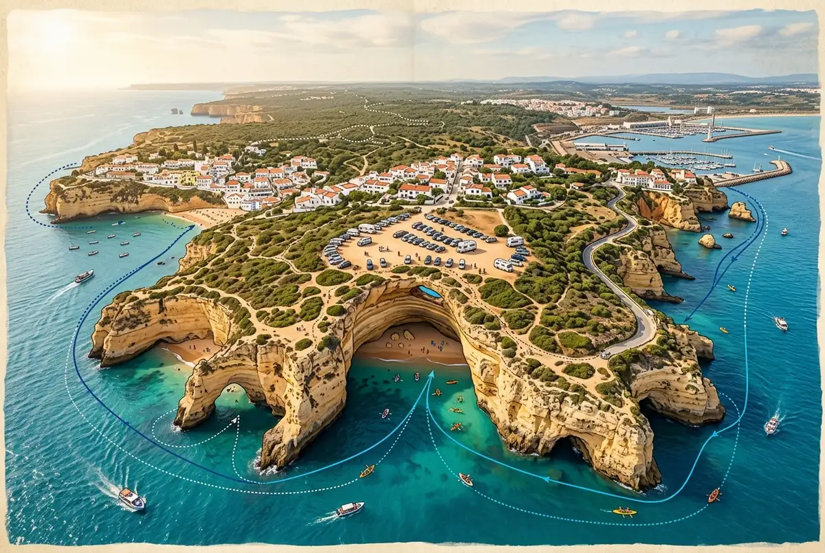
A useful Benagil caves map does more than pin one location. It needs to show the cave itself sitting on the water below Benagil village, the clifftop parking and staircase above it, and the handful of harbor towns along the coast, Portimao, Lagos, Albufeira, Carvoeiro, where the boats that actually reach the cave depart from. I’d study all three layers before deciding how you’re getting there, since picking the wrong one is the single most common planning mistake I see.
What Should a Benagil Caves Map Actually Show You?
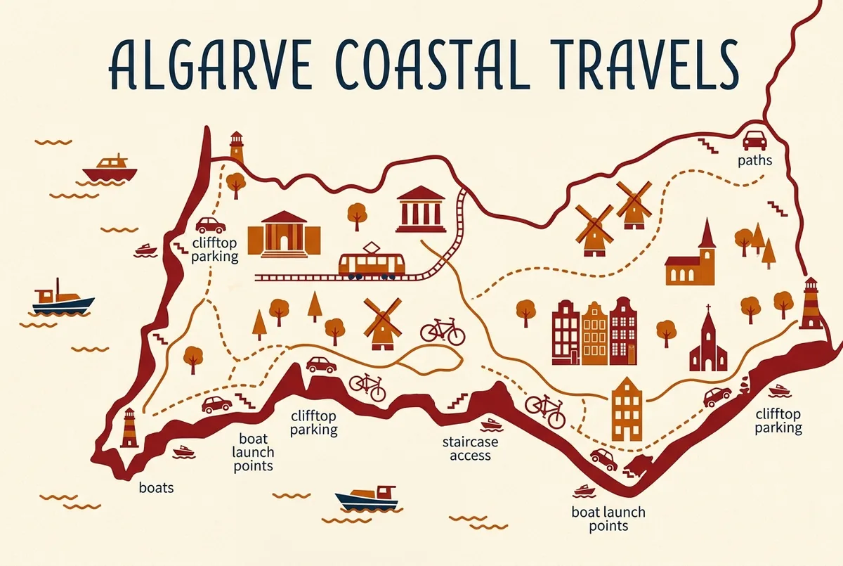
A genuinely useful map for this trip needs three layers: the cave’s location on the water, the village’s clifftop parking and staircase access point, and the departure harbors for boat tours along the coast. Most generic tourist maps only show the first layer, which is why so many visitors end up confused about how to actually reach the cave once they’re standing at the clifftop.
I’d specifically look for a map that marks Portimao, Lagos, Albufeira, and Carvoeiro as separate departure points, since which one applies to you depends entirely on which tour or base you’ve chosen, not on the cave’s fixed location.
Where Is the Benagil Cave on the Wider Algarve Portugal Map?
On an Algarve portugal map with towns marked, Benagil sits on the southern coast, in the Lagoa municipality, between Portimao to the west and Albufeira further east, with Carvoeiro sitting just next door. I’d use Portimao as your main reference point if you’re new to the region’s geography, since it’s the largest nearby town and the busiest departure point for boat tours.
Our Benagil cave location guide covers this same geography in written form, with exact coordinates and drive times, if a map alone doesn’t give you enough context on how the towns actually relate to each other.
Where Do Boat Tours to Benagil Cave Actually Launch From?
Boat tours reaching Algar de Benagil depart from several different points along the coast: Portimao harbor, Lagos marina, Benagil village beach itself, and Albufeira, each running a different boat type and route to the same cave. I’d map this out against your own base before booking, since choosing a tour that departs an hour from where you’re staying adds real, avoidable driving to your day.
The speedboat tour launches from Portimao, the catamaran tour departs Lagos marina, and the express boat tour leaves right from Benagil beach itself, which I’d genuinely call the most convenient option if you’re already staying close by. If you’d rather see every option in one list, the boat tours to Benagil Caves page shows prices and departure points together.
Where Should You Park for a Self-Drive Visit to Benagil?
Clifftop parking directly above Benagil village is the main option for self-drive visitors, connected to the beach and the wider coastal path by a steep staircase. I’d map your route to arrive here early, since this small lot fills up fast in peak season, often by mid-morning in summer.
Our Benagil Caves parking and driving guide covers this clifftop lot in full detail, including overflow options and what the walk down actually involves, if you’re planning to drive yourself rather than join a tour.
Is There a Walking Route Into the Cave Marked on Any Map?
No, and I’d flag this clearly since it’s a common misreading of the geography. No map shows a walking path directly into Algar de Benagil, because none exists. The only ways in are by swimming, kayak, paddleboard, or boat from the water side, all launching from the village beach or a nearby harbor.
I’d double-check any map or route you’re following specifically for this, since a few unofficial hiking maps of the wider coastal path can make it look like a clifftop trail connects directly to the cave mouth, when in reality that path runs along the top of the cliffs, well above the water.
What Landmarks Should You Look for Near Benagil on a Map?
Praia da Marinha, regularly ranked among Europe’s best beaches, sits a short drive east along the same stretch of coast, alongside Praia do Carvalho and Praia da Albandeira, both worth marking if beach-hopping is part of your plan. I’d add all three to any map you’re using, since they sit close enough to Benagil that skipping them to save time barely saves anything.
The Cathedral Cave and several smaller, unnamed grottoes also sit along this same coastline, usually passed on boat routes heading to or from the main cave. Our Benagil sea caves guide marks out exactly where these sit if you want the fuller picture beyond the one famous cave.
How Does Lagos Fit Into the Benagil Caves Map?
Lagos sits further west along the coast, roughly 35 to 45 minutes from Benagil by car, and its marina is the departure point for the catamaran tour specifically. If you’re basing yourself in Lagos, I’d spend some time with a Lagos old town map before your trip too, since the old town itself, with its city walls and cobbled streets, is genuinely worth a separate visit beyond just the boat departure.
I’d treat Lagos’s old town and the Benagil cave as two distinct stops on your map rather than assuming proximity, since the drive between them is real and worth planning around rather than squeezing into the same short window.
How Do You Get From Faro Airport to Benagil on a Map?
Faro airport sits to the east, roughly an hour to an hour and a half from Benagil depending on traffic and your exact route, making it the most common arrival point for international visitors. I’d map this leg specifically if you’re planning a day trip straight from arrival, since it’s a longer stretch than any of the town-to-town drives within the region itself.
Our getting to the Benagil Caves pillar covers this and every other route into the area on one page, functioning as the fuller written companion to whatever map app you end up using on the day.
Should You Use a Printed Map or a GPS App for Benagil?
I’d use a GPS app over a printed map for the actual drive, since Benagil’s exact clifftop parking area and the harbor departure points are all searchable and precisely pinned in most modern map apps now. A printed map is still useful for the bigger-picture regional planning, seeing how towns relate to each other, but I wouldn’t rely on one for the final approach into Benagil village itself.
Signal can be patchy in a few spots along this coastline, so I’d download your route or save the pin offline before setting out, particularly if you’re driving rather than joining a tour where the operator handles the navigation for you.
Does a Benagil Caves Map Show the Cathedral Cave and Other Grottoes?
Not always, and this is worth checking specifically if you’re relying on a generic tourist map rather than a dedicated route guide. Many simplified maps mark only Algar de Benagil itself, leaving out the smaller cluster of caves and arches that sit nearby along the same stretch of cliffs, including the Cathedral Cave.
I’d look specifically for a map or tour route description that names these additional formations, since a boat tour covering all of them, rather than a fast there-and-back to just the one famous cave, is generally a better use of your time on the water. Our Benagil sea caves guide names and describes each of these formations individually, which pairs well with a map showing their general position along the coast.
How Do You Mark the Beach at Benagil Versus the Cave on a Map?
This is one of the more common mapping confusions I see, so I’d flag it clearly. Praia de Benagil, the village beach with clifftop parking and a staircase down to the sand, and Algar de Benagil, the sea cave itself, are two separate points that sit close together but aren’t the same location. A good map marks both distinctly, usually with the beach at the base of the staircase and the cave a short distance around the headland.
I’d double check which pin you’re actually looking at before planning your day around it, since assuming the beach pin gets you into the cave, or vice versa, leads to a frustrating surprise once you’re standing there. Our Praia de Benagil guide covers exactly what sits at that beach-side pin, distinct from the cave itself.
What Does the Route from Carvoeiro to Benagil Look Like on a Map?
Carvoeiro sits just a short distance west of Benagil along the same coastal road, generally 10 to 15 minutes by car, making it one of the closest departure towns for a self-drive or boat-tour visit. I’d mark this route specifically if you’re staying in Carvoeiro, since it’s genuinely one of the more convenient bases relative to the cave’s exact location.
Boat departures from Carvoeiro harbor also reach the cave along a scenic coastal route that passes several of the smaller grottoes mentioned above, which I’d factor in as a bonus if you’re comparing departure towns purely on distance. A short crossing doesn’t necessarily mean a shorter, less interesting boat ride.
How Do You Find the Meeting Point for a Specific Boat Tour on a Map?
Every boat tour operator publishes a specific meeting point, a marina berth, a stretch of harbor wall, or in some cases a spot directly on the sand, and I’d always pin this exact point rather than assuming it matches the town’s general harbor location. Ports like Portimao and Lagos are large enough that the wrong pin can put you a genuine ten-minute walk from where you actually need to be.
I’d screenshot or save the exact meeting point description from your booking confirmation before setting out, since relying on memory or a general search for “Portimao harbor” has sent more than a few visitors to the wrong stretch of waterfront at exactly the wrong time.
Does a Map Help You Judge Boat Tour Length and Route?
Yes, and I’d use one specifically for this before comparing tour options. Looking at a map of the coastline between your departure harbor and the cave gives you a rough sense of whether a listed tour length reflects a leisurely route past several caves and beaches, or a fast, direct there-and-back run. Two tours priced similarly can cover genuinely different amounts of coastline.
I’d cross-reference a tour’s stated duration against the map distance from its departure point to Benagil specifically, since a longer duration from a farther harbor, Albufeira for instance, often means more time simply traveling rather than more time actually exploring caves. Our Benagil Caves tours comparison lays out duration and departure point side by side for exactly this reason.
Beyond the immediate cluster around Benagil, I’d mark Silves, with its Moorish castle, and Loule, known for its covered market, as worthwhile inland additions if your trip allows more than a single coastal day. Both sit a reasonable drive from the Benagil area and offer a genuinely different flavor of Algarve than the coastline itself.
I wouldn’t try to cram everything into one day, though. A map that looks compact on screen can still mean a couple of hours of combined driving once you actually add up several stops, so I’d pick one or two additions per day rather than treating the whole region as a single loop.
How Does a Map Help You Compare Boat Tour Departure Towns?
Laying Portimao, Lagos, Albufeira, Carvoeiro, and Benagil village itself on the same map makes the departure-town decision far easier than comparing tour listings in isolation. I’d specifically look at which harbor sits closest to where you’re already staying, since that single factor usually matters more to your actual day than small differences in boat type or tour price.
A map also makes clear just how much further Albufeira sits from the cave compared to the other four departure points, which I’d weigh seriously if you’re staying there and deciding between the extra drive time and a tour that departs somewhere closer to your base instead.
Does the Map Change Between High and Low Tide?
The visible shoreline does shift with the tide, exposing more rock and sand at low tide around the cave mouth and along nearby beaches, though the core launch points and parking areas on a map stay fixed regardless. I’d still check a tide table alongside your map if swimming or kayaking is part of your plan, since low tide generally means calmer conditions right at the cave entrance.
I wouldn’t worry about this affecting a standard boat tour, since operators already factor tides into their scheduling and routing. It matters more for anyone planning a self-guided swim or paddle out from the beach, where reading the water correctly on the day genuinely helps.
Photographers should factor tide into their own map planning too, since the exposed rock and sand at low tide changes the framing of a shot noticeably compared to a high-tide view with water reaching further into the cave mouth. I’d check both a tide table and a map together if a specific shot is what you’re after.
My Recommendation
I’d map out your trip in three layers before you go: your departure town relative to Benagil, the specific harbor or parking point your chosen tour or self-drive plan uses, and the nearby beaches and caves worth adding if you have extra time. Skipping straight to a pin on the cave itself is where I see most trip planning go wrong.
For the written companion to this map, our Benagil cave location guide covers the geography in full detail, and our getting to the Benagil Caves pillar covers every route in from the region’s main towns and Faro airport.
According to Turismo do Algarve, the official regional tourism board, the Lagoa coastline’s cluster of sea caves and beaches is one of the most visually dense stretches on any Algarve tourism map, which is exactly why getting your bearings before you arrive pays off.
Frequently Asked Questions
Where is Benagil cave on a map of Portugal?
On the southern Algarve coast, in the Lagoa municipality, between Portimao and Albufeira, close to Carvoeiro.
Does a map show a walking path into the Benagil cave?
No. There’s no walking route into the cave. It’s reachable only by swimming, kayak, paddleboard or boat from the water.
Where should I park to visit Benagil cave by car?
Clifftop parking directly above Benagil village, connected to the beach by a steep staircase. It fills up fast in peak season.
Which towns should I look for on an Algarve map near Benagil?
Portimao, Carvoeiro, Lagoa and Albufeira sit closest, with Lagos and Faro a bit further along the coast in either direction.
Is Lagos close to Benagil on the map?
Not immediately. Lagos sits about 35 to 45 minutes west of Benagil by car, though its marina is a departure point for one of the boat tours.
benagil caves →